E&P Data Management on GIS
An Integrated Exploration & Production Data Management System
A comprehensive GIS-based data management platform for the exploration and production sector, centralizing subsurface, operational, and geospatial data to improve decision-making and accelerate upstream workflows.
Key Challenges
01
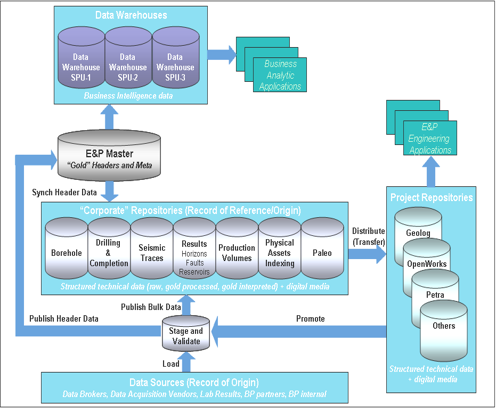
Consolidating disparate exploration and production data from multiple sources into a single unified system
02
Integrating GIS mapping capabilities with subsurface and production datasets for spatial analysis
03
Ensuring data integrity and version control across a large volume of geoscience and engineering records
04
Enabling multi-user access with role-based permissions across geographically distributed teams
05
Providing fast querying and visualization of large geospatial and time-series datasets
About the Project
Integrated E&P Data Platform
The client operates across multiple exploration blocks and required a centralized system to manage well data, seismic surveys, production records, and field maps. The platform needed to support both technical teams working with subsurface data and management teams requiring high-level operational visibility through GIS-based dashboards.
Unlocking Success
IDEATION:
We conceived a GIS-first data management architecture that places spatial context at the centre of all exploration and production data, making it easy to correlate well locations, seismic data, and production performance on a single interactive map view.
OUR APPROACH
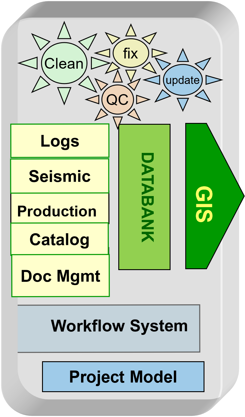
We built a layered data integration framework connecting existing databases, field instruments, and document repositories into a unified GIS platform. Role-based access controls, data validation workflows, and audit trails were implemented to maintain data quality across all user groups.
OUTCOMES
The platform gave teams a single source of truth for all E&P data, reducing time spent searching and reconciling records. GIS-based visualizations improved spatial understanding of assets, while streamlined data workflows accelerated reporting and regulatory submissions.
Project Outcomes
01
Delivered a unified GIS-integrated platform consolidating well, seismic, and production data across all exploration blocks
02
Implemented role-based access and audit trails ensuring data integrity and compliance with regulatory requirements
03
Reduced data retrieval and reporting time significantly through centralised search and spatial querying tools
04
Enabled collaborative multi-user workflows across distributed geoscience and engineering teams